LiDAR sensor and TREX-CAPTURE
Over the last few months, our team has been working on the analysis of LiDAR data. A significant advance for the various markets targeted by our solutions.
At NESTOR TECHNOLOGIES, we like to challenge ourselves with a variety of existing technologies. That’s why we work with a range of sensors, including LiDAR sensor.
What is LiDAR sensor?
First, it stands for “Light Detection And Ranging”. Light is reflected on the surface of an object, and the distance is calculated point by point.
This laser-based technology acts as a sensor, enabling fast, accurate distance measurements at different angles, even in very low light conditions. All the data collected can be used to generate a 3D map of an environment. For some years now, one of the major applications has been autonomous cars and mapping systems.
LiDAR data processing
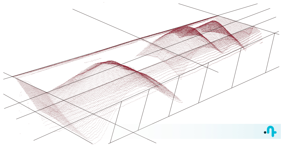
TREX-CAPTURE can now generate 3D maps from LiDAR data, thanks to new metrology algorithms developed by the NESTOR TECHNOLOGIES team. These are included in the latest TREX Software Suite Update (since november 2023).
In practice, by equipping a hopper car loeading/unloading site with our software combined with LiDAR, we identify each hopper car in the convoy and help determine whether or not material is present. The degree of accuracy is in the cm3 range. It is therefore possible to automatically indicate whether a passing car is considered empty or not.
The operator can see a false-color display of the point cloud on the screen. This represents each wagon, with or without load.
This saves time, improves safety, increases precision and thus optimizes efficiency for our customers. So, a bulk container loader can now quantify the material to be loaded with much greater precision.
This control becomes very useful to ensure the correct loading of wagons intended for transporting ore, ballast, grain, etc.
Finally, if you’re interested in an automatic recognition solution based on LiDAR data processing, contact us!
You may also be interested in these articles
LiDAR sensor and TREX-CAPTURE
Over the last few months, our team has been working on the analysis of LiDAR data.
General principle of automatic license plate recognition
What is the general principle for recognizing the characters on a vehicle's license plate within an …
The Transport of Dangerous Goods and our ADR engine
NESTOR TECHNOLOGIES offers automatic identification of ADR plates and labels, used for the Transport…